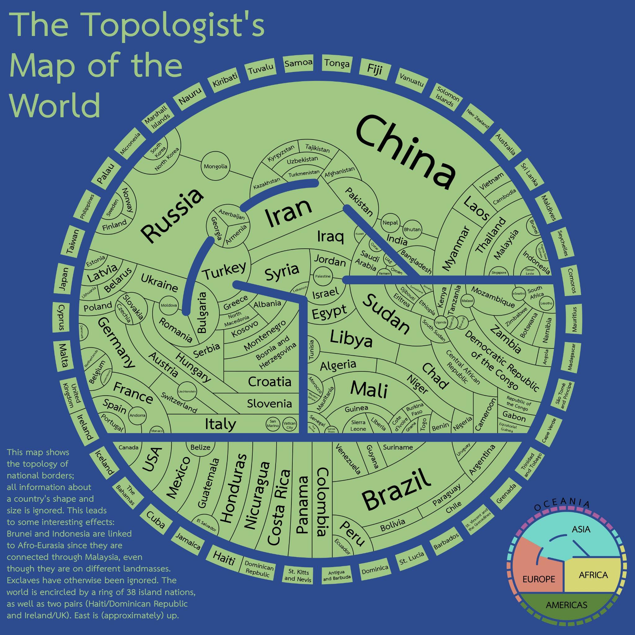
There are several seas here: Red, Mediterranean, Black and Caspian. The Arctic and Antarctic Oceans are not represented, that’ll minimize the perimeters of Canada and Russia.
Overall, this is a very intriguing visualization of the political world. Fascinating stuff. Which I’m not sure I fully understand, don’t get what “topology” refers to, but to me it evokes an image highlighting different altitudes, as with mountains, valleys and coastlines.
If altitude is portrayed I don’t see it. I think this map is purely to show borders/adjacency without consideration of size and only vague consideration of location. Size kinda sorta correlates with the number of adjacent countries but also seems a bit arbitrary.