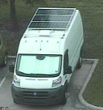
I subscribe to the RSS feeds of all the NF/BLM districts I boondock in while snowbirding. So I knew that a small section of NF land outside Santa Fe, NM where I was headed next was closed for a year.
I picked a spot at least a mile outside the “designated area” that was closed.
A friendly ranger pulled up this morning and asked how long I’d been here (4 days). He started to gently/professionally inform me the area was closed. I pointed out this spot was outside the designated area. He was skeptical and rechecked the map on his phone.
I think he was embarrassed (and thinking of others he might have punted) because he wanted to show me how hard the map was to read on his phone. He also said I was the first person he talked to that had actually read the closure notice. We commiserated a while about the misuse that caused the closure.
He was a good guy and I assume he will go back and clarify the situation for anyone else he misinformed.
#takeaways
- reading the district’s announcements can be both directly and indirectly useful
- bringing up the NF’s official language (“designated area”, “dispersed camping”) seems help establish rapport


Reminds me of a few months ago when part of Lincoln National Forest closed due to the the fires near Ruidoso.
The closure notice described the designated area for closure in such a way it was very hard to understand and visualize, and this closure notice didn’t include a map of the closed area. I had to just call the Capitan Ranger District HQ and ask if the area in which we planned to dispersed camp was open or closed. I thought it was in the designated area for closure, but the ranger said it wasn’t closed and was open!
We moved from Fort Stanton/Snowy River Cave NCA up into the Capitan Mountains - it was a scary drive up the mountain, but we loved it up there.
I saw that on the news. Now the burn scars are causing runoff flooding. :-(
The NF districts really could do a better job of it. At least have an English major read the GIS wonk’s writeup before publishing.
That site is a gem; I try to hit it in spring/fall when I pass through. Too bad the cave is closed because of white nose.
BTW, water fills are free at the nearby paid campsite if one asks the host. Used to be a day use fee for it but they removed that spigot a couple years ago.
We really liked Fort Stanton/Snowy River Cave NCA too - it even brought back memories of limestone hills in Texas’ Edwards Plateau. It eventually got too warm in mid-July while we were there but we plan to go back in cooler weather. In addition, the easy access to Capitan for supplies and Amazon locker deliveries at Brewer’s gas station was convenient (I did some van repairs using some Amazon supplies we picked up).
At the time Rob Jagger’s Campground was closed for an equestrian event unfortunately, so we ended filling up water in Capitan at Mama Bear’s RV park for a small fee ($5 I think).