• 216 Posts
  • 102 Comments
Joined 1 year ago
cake
Cake day: June 10th, 2023

help-circle


  • The Dorothy Eady always stuck with me. It’s fairly well documented.

    After falling down the steps at home, she nearly died. When she came back to life, memories were unlocked of a prior life in Egypt in which she was a priestess in an egyptian temple. She would go on to have a very successful career working in Egyptian antiquities.

    As for the really really weird shizz, anyones guess. I try not to just arbitrarily cut someone down, but it’s unlikely there would be proof of her having a conversation to an ancient diety.


  • jay2@beehaw.orgtoU.S. News@beehaw.orgGroundhog Day 2024
    link
    fedilink
    English
    arrow-up
    4
    ·
    9 months ago

    I am from Pittsburgh and it’s a huge party at Gobbler’s Knob, Pennsylvania. Shut down the town kind of party. An absolute sea of people. It’s been like that long before the movie, but then there’s not much to do in February.

    This years Punxsutawney Phil predicted an early spring but do note that marmots are not exactly qualified to make to make meterological forecasts. It’s a mostly cute tradition with a hint of madness, kinda like sticking a tree in your living room and hanging up socks to celebrate the birth of Jesus at Christmas. Makes total sense when you’re drinking.

    For the record, Groundhogs (or woodchucks) are pretty docile and cute. They are also excellent climbers. This little fellow was quite curious about me, and why I was hiding in his field (taking pictures of birds).


  • I built a PC for my little sister in 2007. She was starting college and didn’t have a computer. It totaled 2805 and some change, custom built through Antares Digital (When you know, you Lili). These were all top of the line components (Asus M2N32-WS PRO, Amd athlon64 X2 AM2 5200, Corsair Memory). Not a cheapy system in its day.

    Three nights before I was to deliver it to her, I completed all of the setup, had all the software ready to go, even setting up a custom theme for her (We were both metalheads). My folks said that she would need a printer/fax/copy/scanner as well, so last minute, I ended up buying an HP 5610 at target for 192 dollars.

    The HP instructions didn’t say that if you connected the cable between the printer and the PC before you had installed the drivers, the printer would not mount as a device. In fact, it would never connect to that PC ever again. Apparently, it ruined the registry until you reformatted and reinstalled the OS.

    To be fair, the manual did say to install the drivers first, then the cable, but this was not the norm back then and they didn’t really emphasize it in any way, nor did it mention that you were about to be FITA big time. Had to scramble to completely reformat the drive, reinstall all the software… Essentially, starting over from a blank slate and getting done in 2 days for delivery to her dorm on move in day. It did connect second time around.

    I wrote them an angry letter regarding the poor deployment, but of course I never heard back from them. Never bought another HP for myself or anyone else ever again. I go out of my way to encourage people to not buy anything from HP. If I happen to be somewhere and see someone looking at an HP printer, I’ll just approach them, introduce myself, and tell them my story to discourage them from buying it.


  • jay2@beehaw.orgOPtoWorld News@beehaw.orgIceland erupts again (1-14-24)
    link
    fedilink
    English
    arrow-up
    1
    ·
    edit-2
    10 months ago

    The aftermath of the January 14 2024 volcanic eruption which has now officially been declared to be over.

    The Map

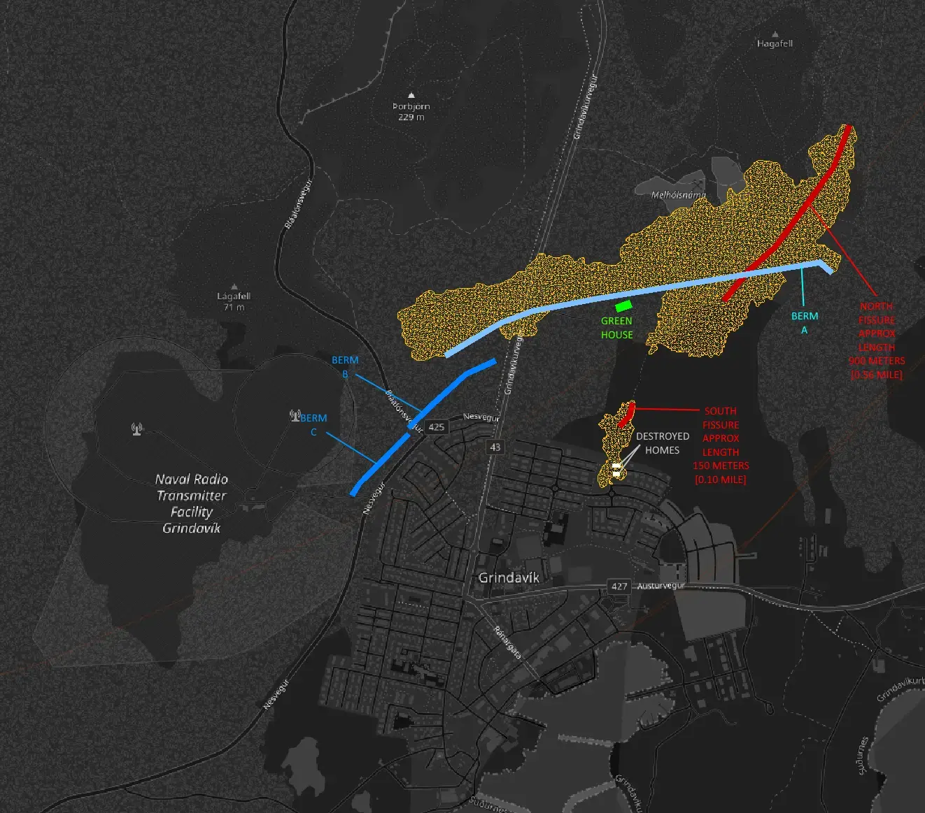
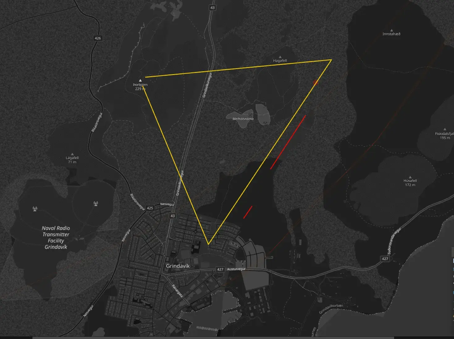
    This is a combination of Agust Gudmundsson’s Satellite Map and the 2D quake map. I used Autocad to import each image and then known features to match the scales and orientations, but it’s still an approximation. Additionally, the satellite image is greyscale and low resolution so the perimeter of the lava field gets hard to discern in some areas with little to no color contrast.

    The Fissures and Lava Fields

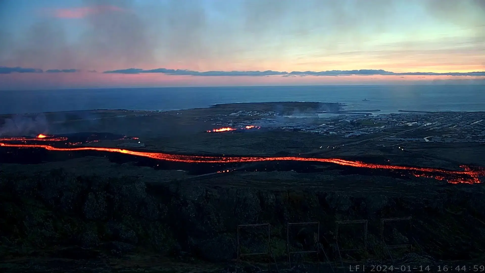
    The two eruptive fissures (north[900m] and south[150m]) are shown in red. It ejected quite a bit of lava, but the experts say they were lucky that the eruption was as weak as it was. The new lava fields from each are in orange. The initial fissure to the north grew in its size as the eruption continued and extended itself underneath the original berm. This extension and the area where the berm crossed the highway allowed lava behind the ber.

    The southern fissure was completely unexpected and it was heartbreaking to witness. While it released a smaller amount of lava at a lower pressure than the north, but due to its proximity to the village, it was enough to destroy at least (2) homes.

    The Berms

    The berms are shown in blue, both the original (lite blue) and the two new additional ones (medium blue).

    The original 10-15 meter high [32-48 foot] berm held up strong and most likely saved the village from much more damage. However, it was not completely effective. A small portion of the berm at the highway had been left open for travel until the day of the eruption when emergency crews plugged it last minute.

    During and since the eruption, the emergency crews have built (2) new berms on the west side of Grindavik to further deflect lava and protect the village.

    The Infrastructure

    The town is still under evacuation order due to the uncertainty of future eruptions and the dangers inside the village due to subsidence and instability.

    Electricity seems to be back on in town.

    The geothermal pipeline that runs tandem (a few meters west) to the north-to-south highway and was destroyed by lava. This is significant in that this supplies Grindavik it’s most abundant heat source, hot water. Homes that were not in harms way are still going to have moderate damage due to frozen pipes. [Edit Jan 21 2024] It was reported that just yesterday emergency crews bypassed the destroyed section of pipe restoring water both hot and cold.

    Two of the reported three homes that were destroyed by lava are shown in white. The north home does not appear on many maps. It was reported to be a new home that was yet unoccupied. The south home was occupied and appeared to be a complete loss. I am still unsure about the third home.

    The greenhouse, shown in green, survived seemingly undamaged thanks the the original berm. It was reported to have had all of its equipment removed prior to the eruption.

    I heard a report that the local government is probably going to be able to offer Grindavik residents a buyout for their homes and property but all I can find is a report that it may be possible.

    250 abandoned sheep were reported to have been rescued and removed on Tuesday Jan 16.

    The Next Chapter

    The future of Grindavik is not looking so good. The data seems to point towards yet another eruption, and likely within the next few weeks.

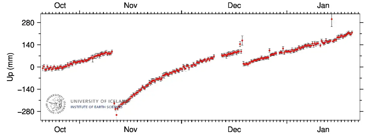
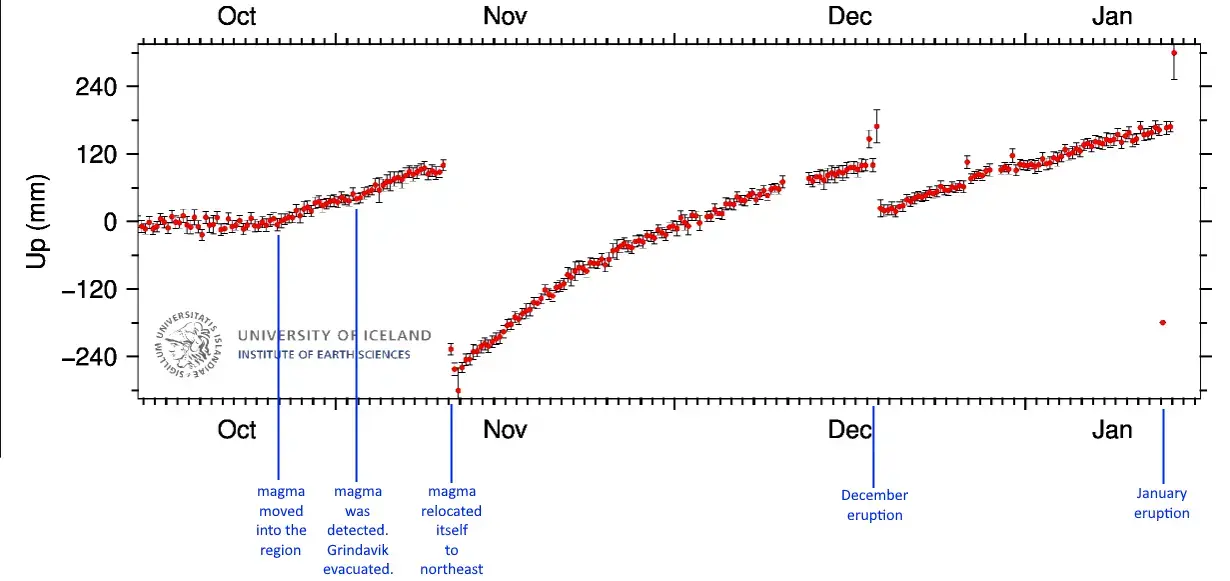
    The Svartsengi GPS Station is near the power plant (north of Grindavik). This is the region where the experts suspect the ultimate source of the magma. It is feeding the magma chamber under Grindavik which is where the eruptive fissures from both December and January formed. It will take months or years of inactivity for this to cool and plug itself. While the system is fed, the pressure will increase. As the pressure builds, the chances of the magma moving or erupting increase. There is no real way known to man as to what exactly is going on down there.

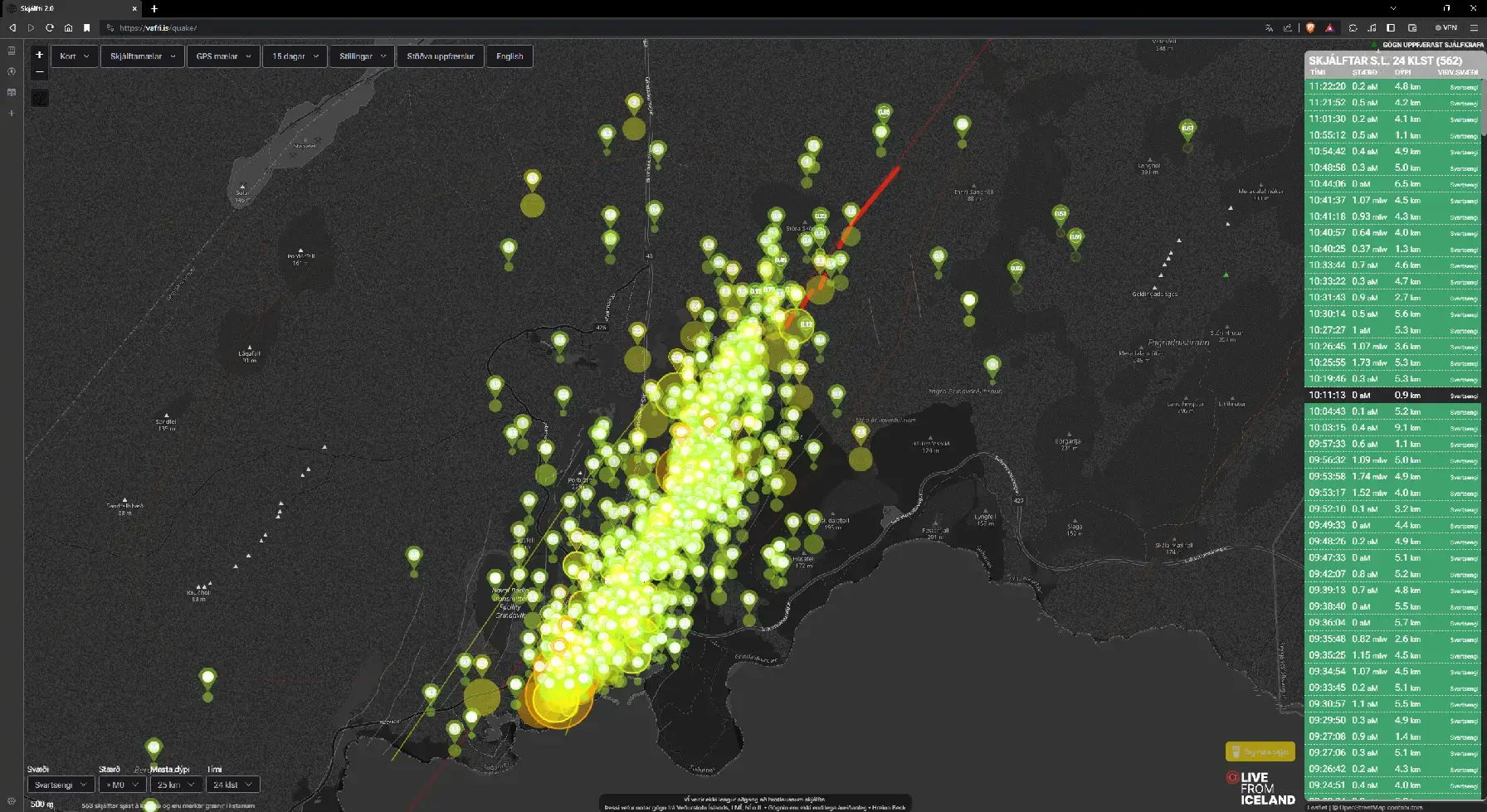
    Earthquakes have been very quiet in the area which is to be expected after the balance of pressure. They have ramped back up through the week but are still low in frequency, size and depth. During the eruption, there were numerous mini-clusters of earthquakes near Grindavik (Locations with a high concentration of earthquakes). One of these locations ultimately became where the southern fissure erupted. There were (2) other mini-clusters south of that fissure well inside of Grindavik. Both of these areas of mini-clusters are above the magma chamber and could be places of a future eruption. With the damage to the area, it could just be stress related fractures.

    Send hope and prayers to the great and brave people of Grindavik.


  • jay2@beehaw.orgOPtoWorld News@lemmy.mlIcelandic Eruption 1-14-24
    link
    fedilink
    English
    arrow-up
    1
    ·
    10 months ago

    Not sure, but I suspect rates just went up. I’m just a science geek from North Carolina that does refractory for a living, hence my interest.

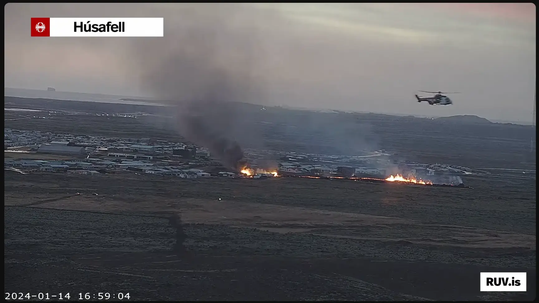
    I watched as the first home caught fire. It was brutal to watch it. I did read that it was not occupied. It does not appear on a lot of maps. The second home though that went up was occupied. This was someone’s home, someone’s place of solace. Children were raised here. Memories were rooted here. It was a total loss. I read that (3) homes in total were destroyed by fire due to the 100km southern fissure’s lava output, though I only saw (2). I am unsure about the third. I am unsure where the third one was.

    Numerous other homes are going to be severely damaged though. Hot water is actually quite abundant I hear due to the geothermal power plant. The lavaflow from the 900km main fissure was mostly deflected by the berm away from Grindavik, but the berm untimately guided it to the pipeline. Geographically speaking and considering the timeframe they had to work in, I don’t think it could be helped.

    I understand that hot water is a primary source of heat since it’s a cheap and abundant byproduct of the powerplant. It’s what you’re also bathing in at the Blue Lagoon Hot Springs. Now devoid of heat, I would suspect that many homes are now going to suffer damage from frozen/busted pipes.

    My heart still goes out to the incredible people of Iceland. I’d like to think I could cope with an event like this, but I’m fairly certain I would puss out. Icelanders are far more metal than I.


  • jay2@beehaw.orgOPtoWorld News@lemmy.mlIcelandic Eruption 1-14-24
    link
    fedilink
    English
    arrow-up
    1
    ·
    10 months ago

    Either a third fissure has opened (there is a mini-cluster of larger magnitude quakes in his area), the second fissure has extended into town, or more homes are catching on fire. It’s getting hard to tell which due to the volcanic gasses (White), smoke (Black) and just the darkness of winter.

    There was a another mini-cluster of earthquakes further to the south edge of town as well. With it’s proximity to the sea it will cause a severe amount of damage.

    I feel this is a historic event. I’m also a refractory designer, which places this squarely in my realm of interest, but it’s heartbreaking to have to watch in slow motion. This would be very cool if it were not for the human element present in these conditions.


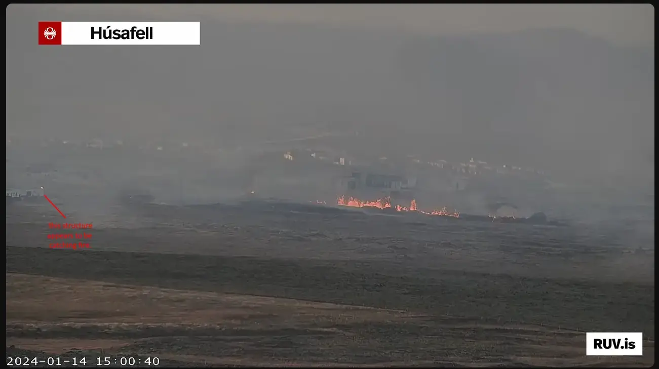
  • I look at the most recent activity and suspect that either a new fissure has opened in the town proper or the southern fissure has lengthened. There exists a mini cluster of larger earthquakes in this area. The best case scenario is that this is a new structure on fire. All three scenarios are rotten-a-f. It is getting hard to tell due to gasses, smoke and darkness.

    That is most likely a RUV news helicopter in the foreground. It’s footage may be available shorty. You can also read their english blog here. Drones are once again banned 4km from town.


  • jay2@beehaw.orgOPtoWorld News@lemmy.mlIcelandic Eruption 1-14-24
    link
    fedilink
    English
    arrow-up
    2
    ·
    10 months ago

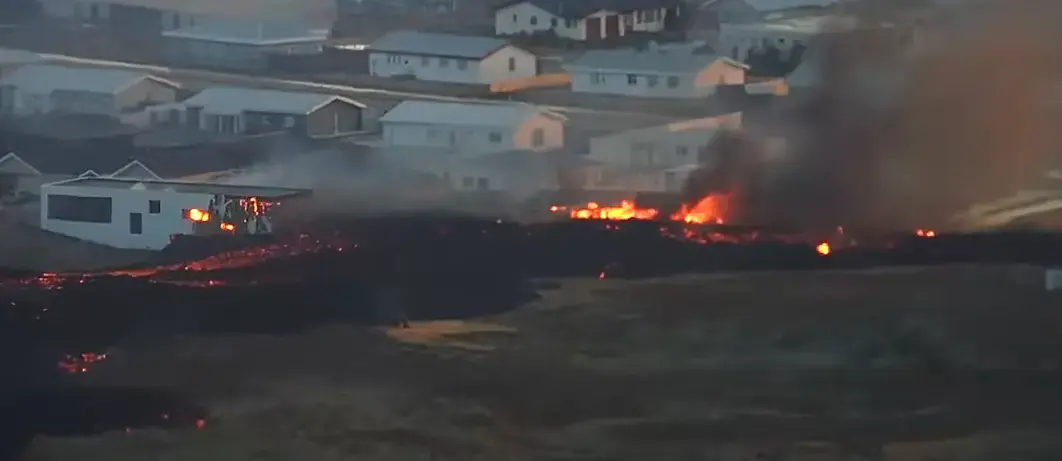
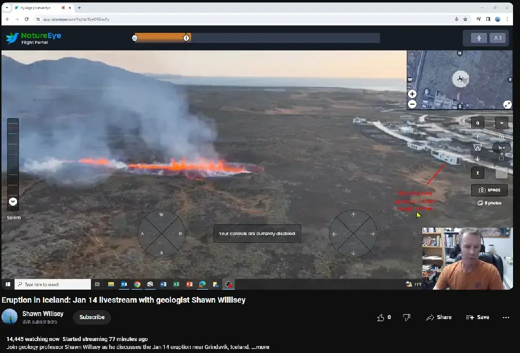
    A close up view frown Professor Shawn Willsey’s livestream showing just how close the southern fissure is to town. This was taken a few hours ago via ariel drone. The vent opened in real time while the drone was flying and observing the northern rift.

    A few hours later, a structure in northern Grindavik closest to the southern fissure appears to have caught on fire.

    If there is any good news to be found, the eruption appears to have lost a bit of its initial thunder.