- 457 Posts
- 165 Comments


 3·9 days ago
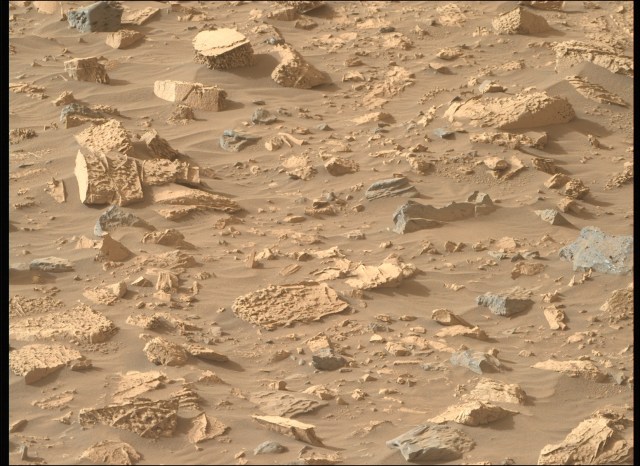
The distance of the drive was 12.7 meters (41.7 ft) towards the Northwest.
During the drive the rover climbed 1.4 meters (4.6 ft).
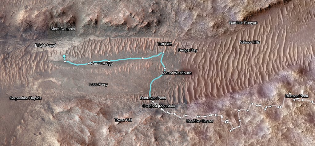
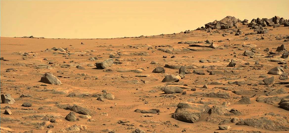
The rover is now at site number 54.1010, stationed in the Northeast of a major science waypoint called ‘Bright Angel’.
The latest map (after a few more drives) should give you a clue ;)
Thank you for the additional information :).
You’re most welcome. I’ll post any updates from the science team, but they are fairly rare
@weariedfae
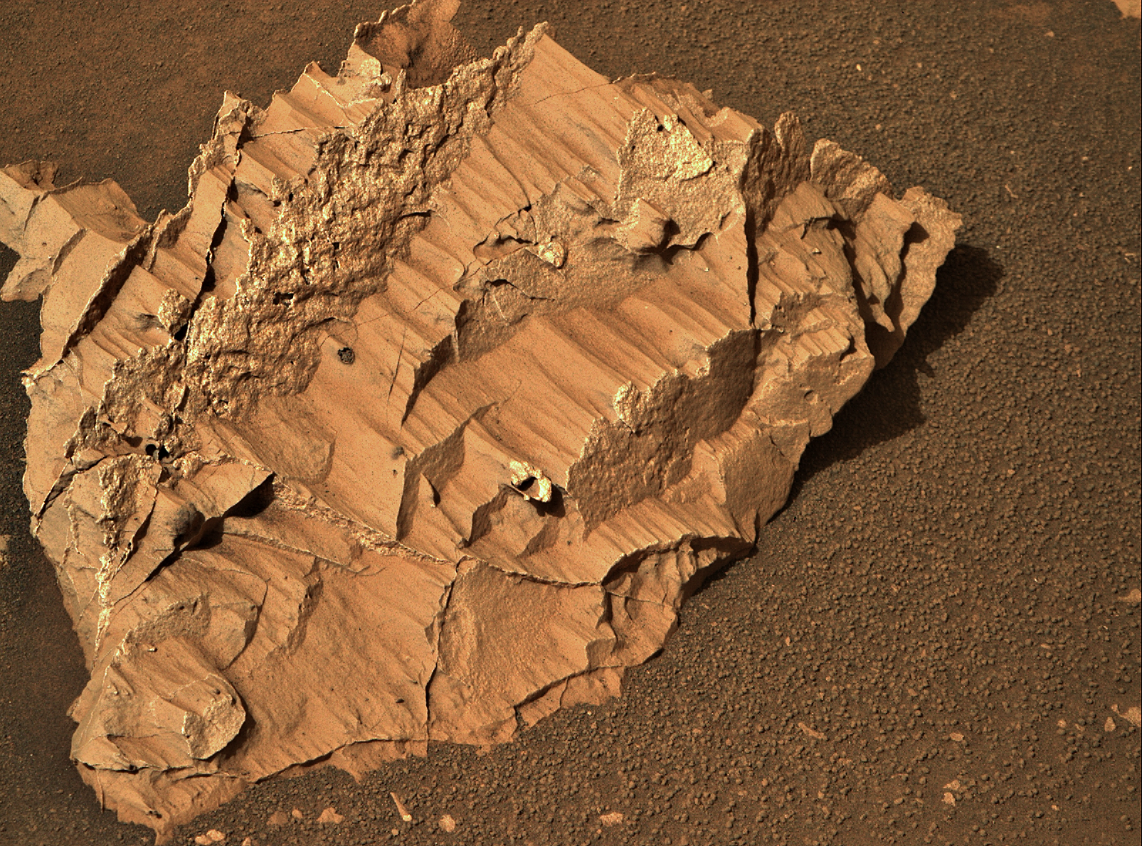
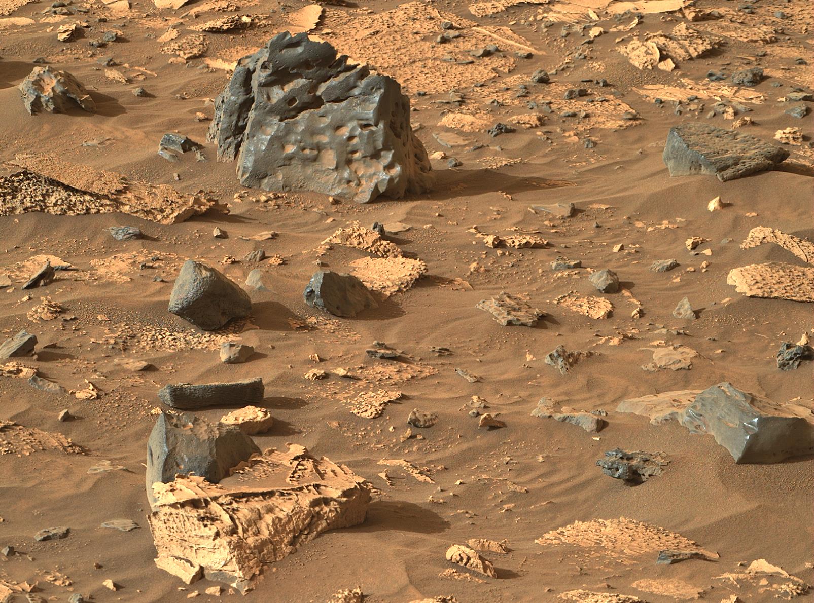
It is possible, as the rover is heading for Bright Angel (BA) it’s the west of the current location. This float rock could be from Bright Angel, so could have been washed down Neretva Vallis by floods etc ~3 billion years ago. BA appears to the white in the HIRISE images, BA is thought to be the oldest rocks the rover will encounter and probably predate the impact that formed the crater, so they could be of volcanic origin… Watch this space
Edit. fixed typos
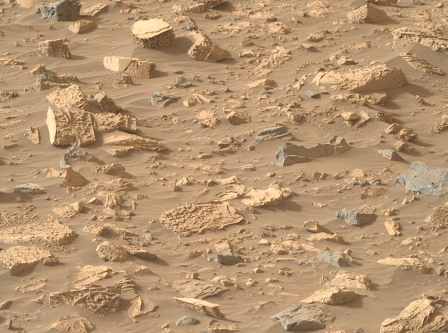
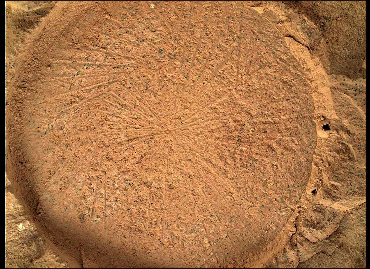
I don’t have tools to scale these images properly, but I estimate the fractured rock is around 50cm to 75 cm wide
You’re most welcome :)
Correct that’s the 2 calibration targets for the mast cameras. It’s not an automatic calibration though in the camera, they image the cal targets regularly and then use those images later in the lab to calibrate the images that come down from the rover. The early colour images that arrive from the rover that we see on the public image server are uncalibrated and compressed for public release, that compression alters the colours a little (adds a green hue, the amount of green depends on the level of compression) I removed that green hue on this post.
You can read more about the target on this link: https://mastcamz.asu.edu/caltarget-fiesta-why-is-perseverance-taking-so-many-mastcam-z-calibration-target-images/
You can find the calibrated MastCam-Z images here : https://mastcamz.asu.edu/mars-images/images-videos/?pg=1
Used to get a lot more views / upvotes on Reddit, but I left Reddit for greener pastures. I’ll keep posting here as long as I’m breathing, even if there’s no upvotes :)
The way I’m reading it is the AutoNav drives were definitely taking us in circles because of the difficult terrain, so they decided to revert to drives within line-of-sight… i.e, they pick a benign path that they can see in the NavCam images, then program that for the next drive. These will always be shorter than AutoNav drives, but the line-of-sight drives are safer and we’ll reach Bright Angel for the next sampling opportunity soon enough…
 4·2 months ago
I’ve had times when I felt I was shouting in the dark on a number of different platforms over the years, but those community don’t last long as they usually grow. The Mars communities here on Lemmy have grown nicely since I came over here from Reddit. I’m sort of paying it forward for all those that preceded me that gave me joy in the late 50’s and 60’s when I was young developing space nerd. I simply gather the data / images to satisfy my own curiosity. Sharing it with a few like minded souls, is only but a few clicks in this digital age :)
Just sharing the passion :)
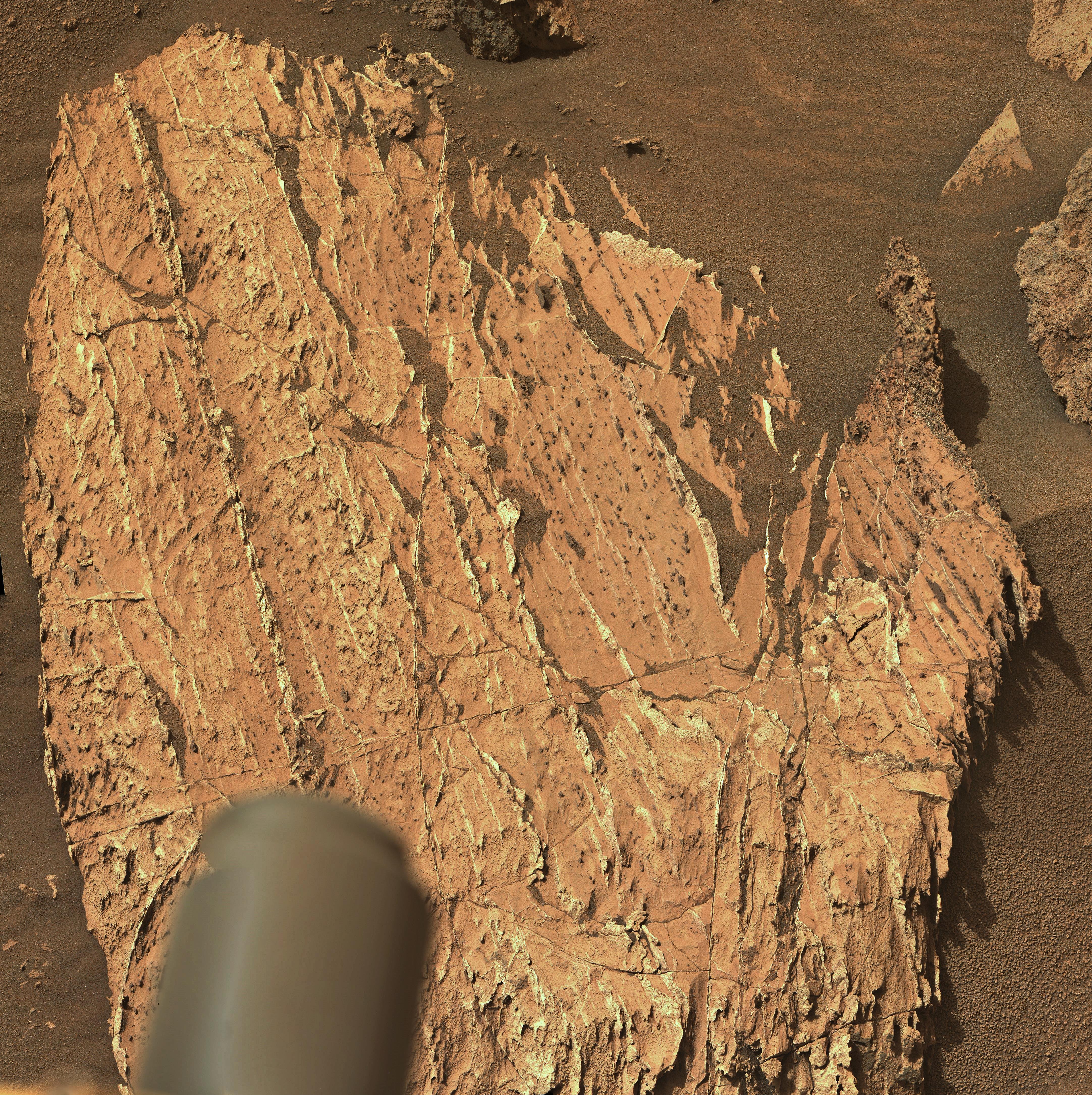
Possibly. There are some pretty wild temperature swings. I’m not a geologist, but I think rocks usually fracture along the plane of their crystalline structure (as it’s the weakest bond)
Let’s propose that these eroded boulders have a different crystalline structure due to the way they were formed / modified by groundwater etc., then they maybe they are fracturing in a piecemeal fashion, and basically crumble away due to the wild temperature swings.
0.13%
Typo - edited - thanks for the heads up :)
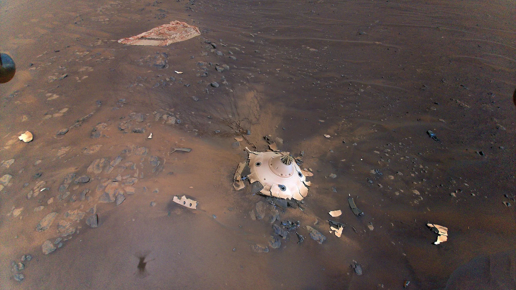
We may see it again in a few years if the rover returns to the crater to drop off the rest of its sample tubes. The Heli’s computer has been reconfigured to monitor temperature, solar charge rates and battery condition. There’s enough memory space for 10 years worth of data, but no one knows how long it will be able to collect that data for. Some here may still be around when that data is retrieved :)
It’s from the cameras. Many of the image gurus have made flat field images to process those and other defect away. Sadly that is above my skill level
Very Clean - But also a white balanced image (the blue skies are a tell-tale of white balancing)
Except for the inability to fly, all of its sensors that were working before the accident on flight 72 and both cameras are still fully functional. So they are still capable of sending the charge data from the solar array and the charge state of the battery and temperatures of the motor cores and batteries etc.
Since flight 72 landed the helicopter has returned 2,362 NavCam images of the ground at the flight 72 landing site from its NavCam, and 36 colour images from its RTE camera, those also featuring the ground, so a total of 2,398 returned so far from the crash site. In total the helicopter has returned 13,945 NavCams and 608 RTE images during its entire mission, all are on the mission image server. (edit typo)
Just a feeling based on the fractures, that’s why I put it out there and asked the question. When we’ve seen mineral filled fractures in rocks on Mars the fractures have usually been in fairly straight lines following the crystalline structure in the host rock, or at separations of the sedimentary layers. It could be an optical illusion, but many of the fractures are far from straight in this target, almost like series of large crystals in a honeycomb like arrangement. The appearance of sandstone could just be a dust covering. Appreciate the feedback :)
Looking forward to hearing how the team call this float rock :)
Edit: fixed typo